maps
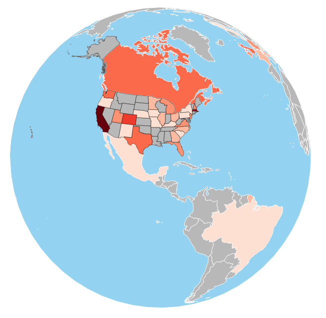
I was able to go to our R&D conference thanks to a show and tell idea I submitted with a co-worker: fun ways to visualize data using the d3.js library. One of the ideas was to build a choropleth map that showed where everyone attending the conference was from. It turned out pretty good (I need to move the source to github at some point, for now…here is a screenshot). The mouse behaviors added a nice level of interactivity (click to drag the globe, mouse wheel to zoom in and out).
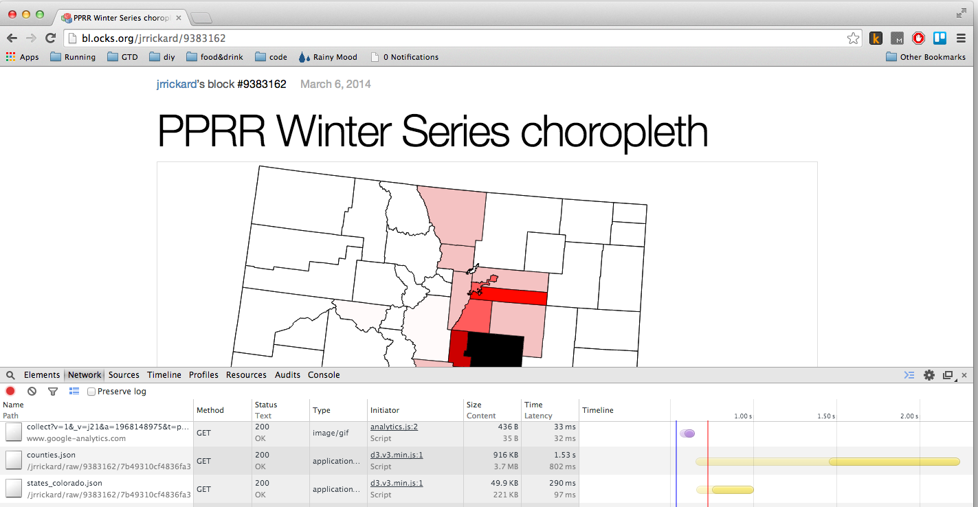
This idea was entirely driven by another idea: visualize the registration data for the Pikes Peak Road Runners Winter Series by county in Colorado. I did an initial version. This was actually really easy to make with D3.
First, I grabbed the US Census Bureau TIGER data for Colorado at the state and county level. Then I used the GDAL ogr2ogr utility to convert the Shapefiles into GeoJSON. Once the files were converted to GeoJSON, I used the queue.js library that Mike Bostock has written and d3.geo.albersUsa projection and had a simple map of Colorado. A few more lines of code and I had a simple choropleth with one major problem: the counties GeoJSON file was almost 4 meg. This would kill the World map of attendees. Solving this problem turned out to be pretty simple though: mapshaper. Mapshaper lets you upload a shapefile, GeoJSON file or TopoJSON file and use a simple slider to simplify the polygons in the file and then export the resulting polygons into the format of your choice. As a test, I uploaded my counties GeoJSON file and reduced the file to 2% of it’s original complexity. At this point, I lost SOME of the complexity of the polygons, but the resulting file was only 103 KB!
The two maps for comparison:
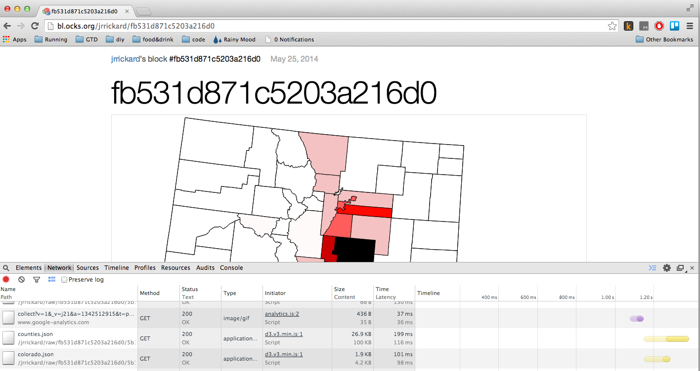
I applied this to my world based map and got a similar reduction in size. The take away from this execrise was to process the data in a way that makes sense for the presentation. This was web based, so a 4 MB download was pretty unacceptable to load the map up. It was even worse for the world-wide country boundaries. Using Mapshaper allowed me to shrink the size of the file without losing much resolution on county boundary within Colorado or country / state boundaries world wide.